The short version:
- Turbidity surges ahead of flow: sediment mobilizes in a watershed before peak flow arrives, so a turbidity sensor can give flood managers valuable lead time that a gauge alone will not
- Global investment in flood monitoring infrastructure runs in the billions annually, and water quality sensors are part of that buildout
- Sensor accuracy of ±1% FS catches the subtle water quality changes that precede visible flood conditions
- Automated turbidity thresholds can trigger emergency protocols without waiting for a human to notice
- SCADA integration turns local turbidity data into coordinated regional flood response
Flooding remains among the most frequent and damaging natural disasters worldwide. UN disaster risk data show that roughly 90% of major disasters over the past two decades were weather-related, with floods the most common type. As climate change intensifies extreme precipitation, municipalities and water resource managers are investing in monitoring technologies that buy response time. Turbidity sensors have earned a place in that toolkit: they catch the sediment signature of runoff mobilization before peak flow shows up on a gauge.
Table of Contents
The Science of Turbidity in Flood Events
Turbidity—the light scattering caused by suspended particles—is a remarkably effective indicator of hydrological conditions that precede flood peaks. Rainfall infiltrates soil, mobilizes sediment, and carries it through the watershed. That process produces measurable turbidity increases that typically precede peak flow by significant intervals.
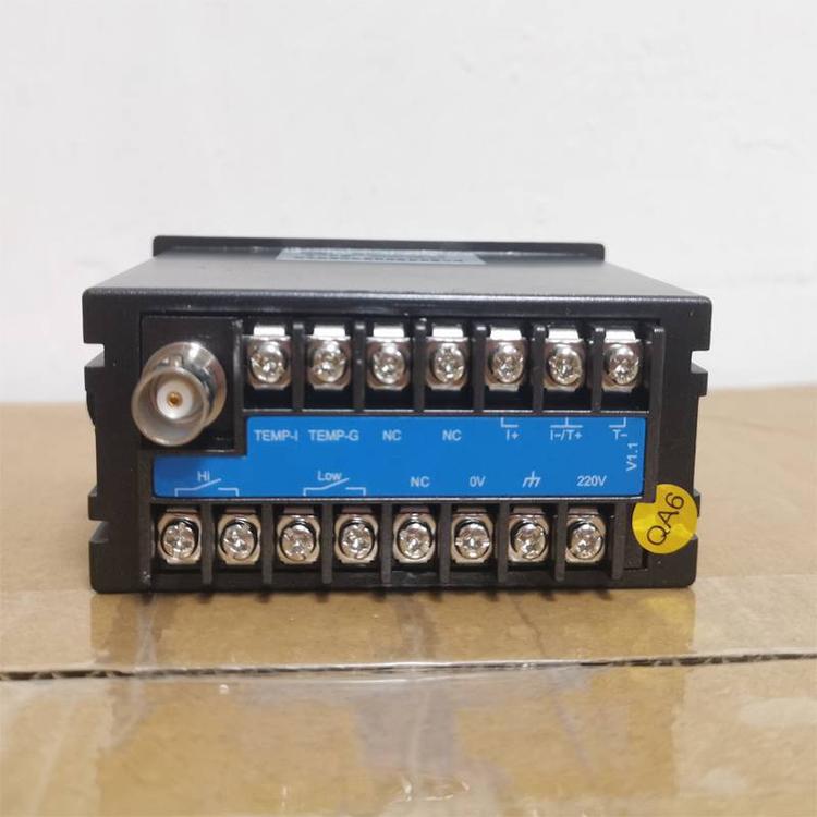
Research by the U.S. Geological Survey has long demonstrated that turbidity correlates strongly with suspended sediment concentration—published watershed studies commonly report correlation coefficients above 0.8. That relationship lets hydrologists estimate sediment loads and infer flow conditions from continuous turbidity monitoring. The Shanghai ChiMay turbidity tester series provides laboratory-grade accuracy (±1% full scale) suitable for both routine water quality assessment and flood monitoring duty.
The timing of the turbidity response varies with the watershed. In urban catchments with extensive impervious surface, turbidity spikes arrive quickly after peak rainfall intensity as runoff races to the monitoring point. Rural watersheds with larger drainage areas lag considerably. Either way, pairing turbidity data with precipitation data and watershed modeling gives flood managers a head start they cannot get from stage gauges alone.
Advanced Sensor Technology for Harsh Environments
Flood monitoring is brutal on instrumentation: high sediment concentrations, rapid flow, debris impact, and wildly variable water levels. Industrial-grade turbidity sensors handle it through rugged construction, automated cleaning, and wide measurement ranges.
The nephelometric method is the standard technique: measure scattered light at a 90-degree angle to the incident beam, which gives excellent sensitivity across the range flood monitoring needs. The Shanghai ChiMay turbidity tester uses an infrared LED light source that minimizes interference from colored dissolved organic matter while holding calibration over extended deployments.
Self-cleaning is not optional in this application. Biological growth, sediment deposits, and oil films on optical surfaces all bias readings upward and progressively wreck data quality. Ultrasonic cleaning, compressed air purges, and mechanical wipers each have their place depending on installation conditions, and regular automatic cleaning cycles keep the data trustworthy while minimizing site visits.
Integration with Flood Warning Systems
Turbidity data delivers most of its value when it is wired into a broader warning architecture. Modern platforms combine turbidity with rainfall gauges, river stage sensors, and weather radar to generate probabilistic flood forecasts. Machine learning models trained on historical events keep improving their predictions as operating experience accumulates.
SCADA integration lets turbidity thresholds trigger automated responses: alert levels for precautionary notification, warning levels for emergency preparedness activation, critical levels for immediate response. Graduated thresholds let resource allocation scale with actual risk instead of opinion.
Responses triggered by turbidity-based alerts range from activating flood barriers and operating control structures to issuing public warnings and alerting emergency services. Integration with paddle wheel flow meters and multi-parameter water quality analyzers adds data streams that validate and refine automated decisions, trimming false alarms without slowing response.
Case Study: Urban Drainage System Monitoring
A major metropolitan area operating a turbidity-based flood monitoring network across its urban drainage system illustrates the pattern. Stations distributed through the drainage network report in near-real time, and when turbidity crosses alert thresholds the system automatically adjusts stormwater retention basin operations and triggers localized warnings.
During a significant precipitation event, the network flagged rising turbidity well before peak flow arrived at a critical drainage confluence. Operators used that lead time to draw down a retention basin ahead of the surge, and the resulting attenuation measurably reduced downstream flooding, protected residential structures, and prevented property damage in the millions. Post-event analysis credited the water quality sensor network with a substantial share of the predictive information the forecast models used—complementary to precipitation and river stage data, not redundant with them.
The specific numbers belong to that city, but the lesson generalizes: sediment moves before the water peaks, and a sensor network that watches sediment gets the warning first.
Economic Considerations and ROI
Flood monitoring infrastructure pays back through avoided damage. Comprehensive monitoring systems meaningfully reduce flood losses compared with unmonitored systems, because every minute of lead time converts into operational actions—basin drawdowns, road closures, evacuations—that blunt the peak.
There is an insurance angle too. Communities enrolled in FEMA’s Community Rating System earn flood insurance premium discounts for their residents—scaled from 5% up to 45% depending on the community’s floodplain management scorecard—and investment in monitoring and warning infrastructure earns credit on that scorecard.
Operational savings stack on top: predictive monitoring enables reservoir operations that bank water for dry periods without sacrificing flood protection, and automated systems cut the labor cost of manual monitoring while improving response consistency.
Equipment costs are manageable. Basic monitoring stations suitable for urban drainage applications typically run $2,500-8,000 per location—sensor, data logger, and communications included. More sophisticated installations with multiple sensors, automated cleaning, and advanced communications range up to $15,000-50,000 per station. Against the cost of a single flood event, the arithmetic is not close.
Calibration and Quality Assurance
Maintaining accuracy through a deployment requires systematic calibration and QA. Laboratory calibration against primary standard solutions traceable to EPA reference methods (EPA Method 180.1 for nephelometric turbidity) is the foundation for trustworthy field measurements. The Shanghai ChiMay turbidity tester series includes automated calibration verification functions that simplify routine QA.
Field verification with secondary standards should run at regular intervals—monthly for permanently installed sensors is a common cadence—with periodic comparison against portable reference instruments for additional confidence. Many utilities keep calibration records for five years or longer to support trend analysis and regulatory compliance.
Zero drift and span drift monitoring catch sensor degradation before accuracy slips. Modern instruments report drift parameters continuously, enabling predictive maintenance scheduling. Replacing a drifted sensor typically costs $400-800 depending on specifications—trivial compared with the cost of decisions made on bad data.
Future Technology Development
Emerging technologies keep widening the gap between monitored and unmonitored systems. Laser diffraction systems add particle size distribution information that should improve sediment load predictions. Hyperspectral imaging measures multiple water quality parameters from a single platform.
Integration with IoT platforms and cloud computing moves the intelligence closer to the data. Edge devices validate readings and generate alerts locally, trimming bandwidth while keeping response fast. Cloud analytics platforms model whole river basins from monitoring networks spanning hundreds of stations.
The convergence of remote sensing, in-situ monitoring, and numerical modeling is where flood management is headed. Satellite precipitation estimates, drone-deployed temporary sensors, and permanent monitoring stations will combine into comprehensive situational awareness during flood events—and turbidity sensors will stay central to it, providing the link between water quality and hydrological conditions that makes early warning actually early.
This article provides technical information about turbidity monitoring technologies for flood management. Professional engineering consultation is recommended for system design and implementation.